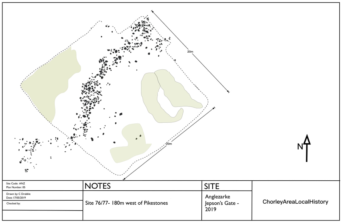
Site 76-77 - Anglezarke Survey 1985
Site 76 was identified in the 1985 Anglezarke Survey as a possible stone wall or feature. In May 2019 a drone survey was carried out of the site, which is at Jepson's Gate, approximately 180m west of Pikestones.
The report states "The stone bank complex (sites 70-72,76-77) has two main sections which lie at right-angles to each other. Both are irregular heaps of stone with no indication of a drystone structure (site 72). They are clearly badly damaged and no function is apparent from the surviving evidence. The complex lies on the peat and must, therefore, post-date the onset of peat formation in the later Bronze Age."
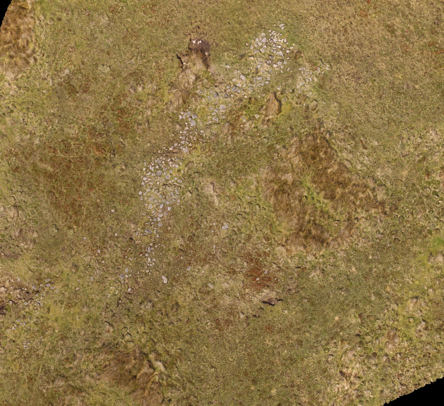
In the lower half of the aerial image (Fig1) you can see the line of stones which is about 20m long with a slight change of direction after 10m. Interestingly, there is a rectangular crop mark surrounding the stones. This crop mark can also be seen in the crop health analysis (Fig2) and is 20m x 20m.
The report states "The stone bank complex (sites 70-72,76-77) has two main sections which lie at right-angles to each other. Both are irregular heaps of stone with no indication of a drystone structure (site 72). They are clearly badly damaged and no function is apparent from the surviving evidence. The complex lies on the peat and must, therefore, post-date the onset of peat formation in the later Bronze Age."
In the lower half of the aerial image (Fig1) you can see the line of stones which is about 20m long with a slight change of direction after 10m. Interestingly, there is a rectangular crop mark surrounding the stones. This crop mark can also be seen in the crop health analysis (Fig2) and is 20m x 20m.
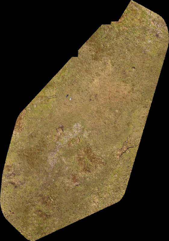
Fig1: aerial view of line of stones contained in a rectangular crop mark.
|
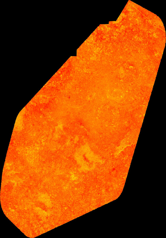
Fig2: NDVI crop health analysis showing crop mark in more detail.
|
The image below show the stone layout in more detail.