John Stone, Duxbury Woods - Initial findings from survey
 Figure 1 - Survey drawing of the area around the John Stone
Note: These are the initial findings from the John Stone Survey. They will be added to over the following months as further surveys and research takes place.
During lockdown, one of our most pleasant local walks was along the banks of the Yarrow through Duxbury Woods. I would always try to spot the elusive John Stone (click here for more details) from the North bank with no luck. I received more details on the John Stone at the end of March, so as the undergrowth was just starting to grow back, I decided to survey the landscape around the John Stone and create a more detailed 3D model of the stone. I suspect, if the stone has not been moved in the past, clues to its age may come from the slightly flatter area to the North.
There were far too many trees for a low level drone survey, and even from above the tree canopy, the ground surface would not have shown in enough detail to capture the elevation profile. A video taken at ground level failed to produce any ground profile due to the number of trees and similar looking ground cover confusing the software.
Fortunately, in 2019 DEFRA released 1m lidar data for this area which I used as a base map for the survey, so along with notes and sketches taken on the site, a plan of the area (Figure 1) could be produced.
General Landscape
Lidar Analysis
The following images have been produced from lidar data SD51se_DTM_1m and were used in QGIS and TouchDraw to produce the survey drawing (Figure 1).
The following images have been produced from lidar data SD51se_DTM_1m and were used in QGIS and TouchDraw to produce the survey drawing (Figure 1).
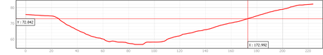 Figure 2 - Yarrow Valley elevation profile (John Stone at XY cross point)
The John Stone is 10m below John Field and 40m from the edge of the field. The Yarrow is 15m below, a further 80m away. The East bank at the point where the John Stone is sited, slopes down more gently than the opposite bank, and other locations along the East bank making this section of the bank more usable.
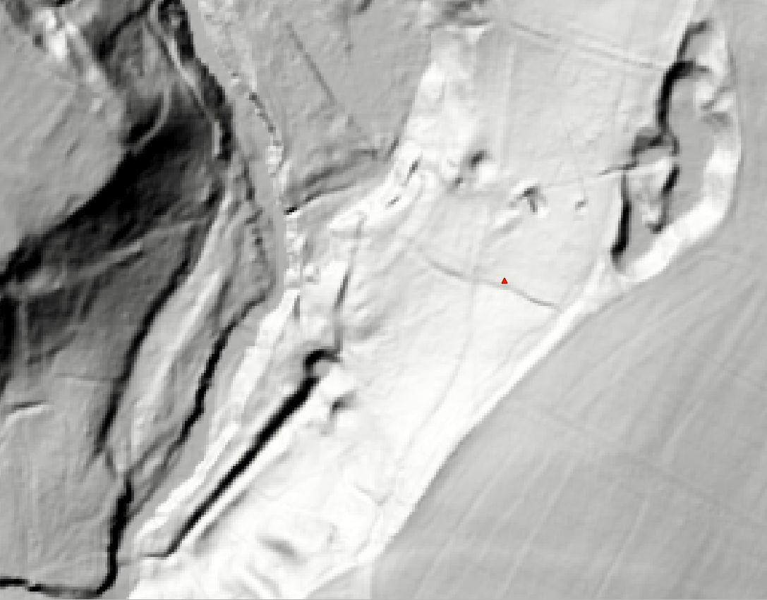
Figure 3 - Hillshade image
|
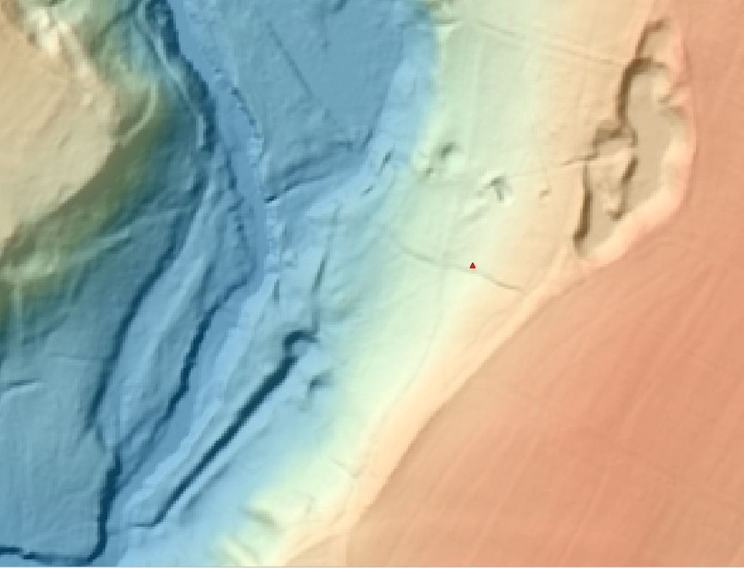
Figure 4 - Elevation image (orange is high ground, blue is low ground)
|
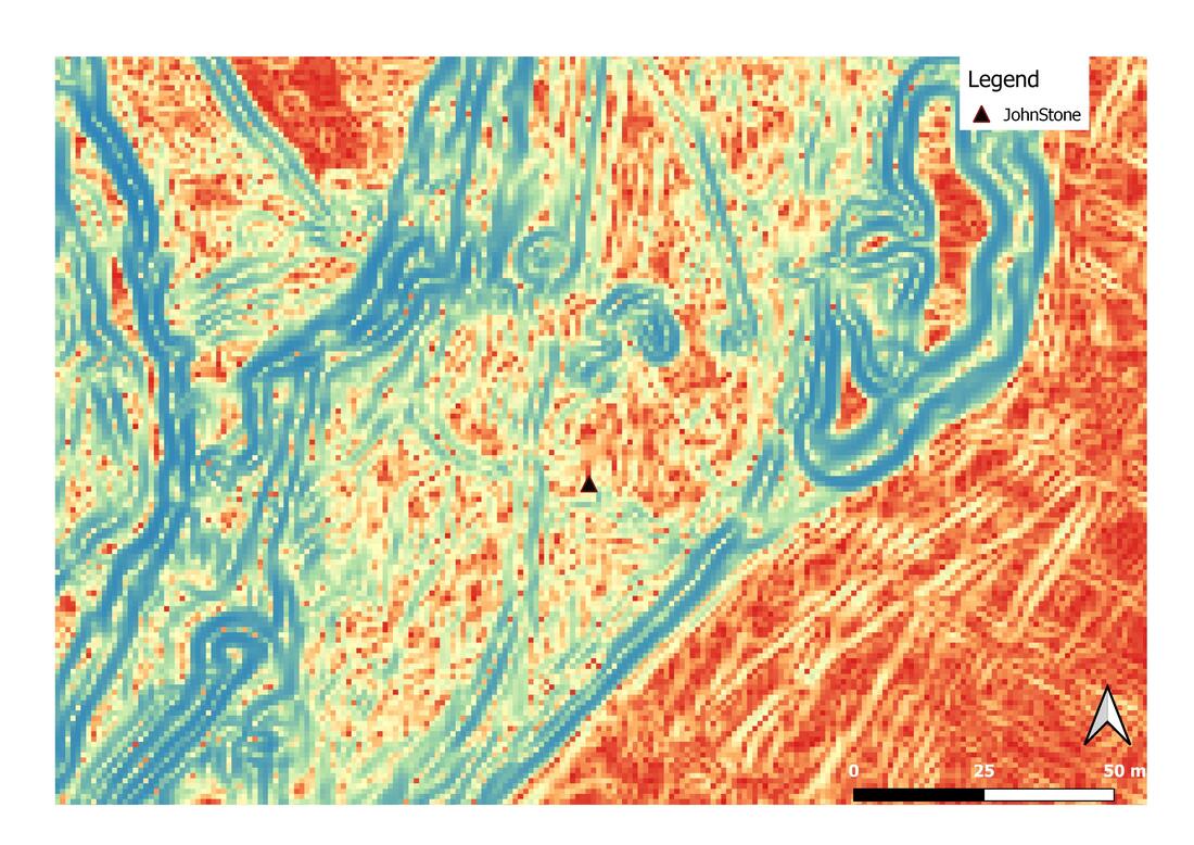
Figure 5 - Edge analysis of the slope profile (blue is steep change in level, highlighting possible tracks, red is flat area)
|
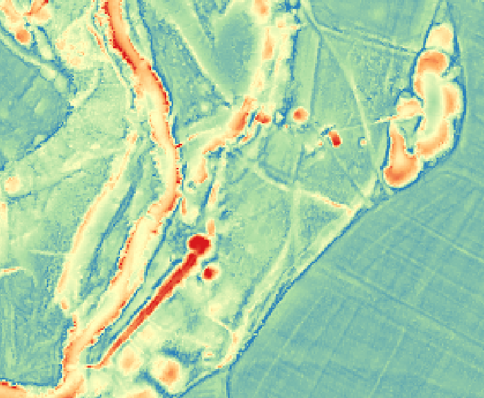
Figure 6 - Slope change image
|
Initial Observations
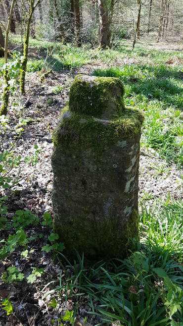
Figure 7 - The John Stone looking down slope. The ditch is marked with brown vegetation.
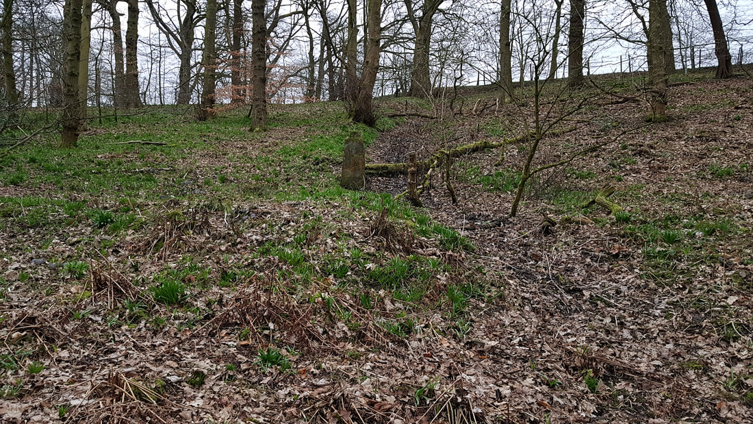
Figure 8 - The John Stone from below looking West
|
The John Stone is a single standing stone. There is no evidence to date that it had a companion. The area to the North of the John Stone is relatively flat.
The John Stone is adjacent to a ditch running East to West down the slope. It is possible that the ditch widens at the point as it pass the stone. The East (higher) section of the ditch has surviving banks 0.5m high. The West (lower) section is only a few centimeters deep, but is clearly outlined by a change in vegetation. This lower section seems to curve North to join other ditches emptying into the old course of the Yarrow. There is a trackway running from the modern footpath along the edge of John Field to a point 10m to the West of the John Stone. This section of the track is still visible, especially if approaching from below, and possibly has a further branch down from the top field closer to the John Stone. It is possible that the trackway runs past the ditch adjacent to the John Stone and through the site. There are several deep pits to the North of the John Stone. Most are circular and up to 2m deep, but one is rectangular with a bank at the Northwest end. There are massive earthworks below this area (a large pit with drain to the Yarrow to the Southwest) which do not seem to be related to the John Stone area. |
|
|
New 3D model of the John Stone
As part of the survey, I created a new 3D model of the John Stone to try again to see if there area any markings on it. The bright conditions make it difficult to study the surface, especially on the far side (turn the model round 180 degrees) which was in shadow at the time of recording. There are hints of lines there. |
Further work
- A more detailed survey will be required. The lidar analysis show there are many more smaller ditches running across this area, which will be difficult to interpret. It may be possible to determine a sequence of events as ditches cut through each other and through trackways.
- The ditch adjacent to the John Stone seems to match a field boundary on some older maps. Much more GIS analysis matching maps from different times is required.
- The age of the pits needs to be determined by further old map analysis.
- The John Stone is unusual with it tenon on the top that seems to serve no purpose. Research suggests that there are as many as 30 of these stones in the local area and have been labeled 'Tenon Topped Gate Posts' in the past. I have identified a couple more and possibly another in the Fylde. The siting of these examples, along with analysis of land ownership may give us more clues to their age.
- Land had been rented to the Hospitallers in the 13C in Duxbury, the woods are called 'John Wood' and the adjoining field 'John Field'. It will be interesting to see if other Tenon Topped Gate Posts in the local area have similar associations.
- Lichen is growing on the surface of The John Stone. Lichenometry may provide some guide as to the possible age of this stone.
