A History of Red Bank
South Chorley
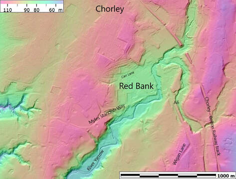
Red Bank is the low lying area around Carr Lane on the Southern boundary of Chorley near the river Yarrow. To the North is the higher Chorley Moor, to the West the higher Eaves Green, to the South and East the river Yarrow.
Red Bank is the only suitable place to cross they Yarrow South of Chorley so has always been a key strategic site in the landscape, certainly as far back as Medieval times, and probably much earlier.
Back in the 1700's and early 1800's the hamlet of Red Bank comprised of a handful of cottages and an inn around an old bridge over the River Yarrow on the main route from Carlisle to London (the A6).
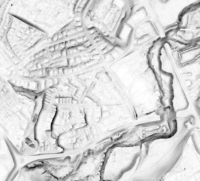
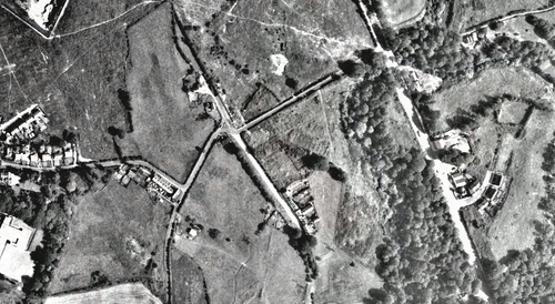 Fig1: this aerial photo from 1960 shows surviving dwellings of Red Bank on the old turnpike road running parallell to the modern A6 with Carr Lane built to connect them.
In 1824 the A6 was re-routed to its current position with a new bridge over the Yarrow, and a new Yarrow Bridge Inn, both still in use today.
This resulted in Red Bank being cut off from the traffic, becoming something of a backwater.
This resulted in Red Bank being cut off from the traffic, becoming something of a backwater.
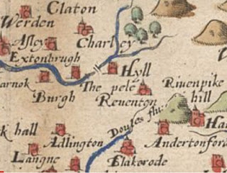
Saxtons map of 1580 shows a bridge over the Yarrow at Red Bank, so it is likely that the area was settled from at least this time, but as this is the only place to cross the Yarrow, it has probably been a key point in the landscape from much earlier.
The earliest mention of an Inn at Yarrow Bridge is from the 1700's and the Inn is thought to be on the Chorley side (north) of Yarrow Bridge which places it in Red Bank.
The earliest mention of an Inn at Yarrow Bridge is from the 1700's and the Inn is thought to be on the Chorley side (north) of Yarrow Bridge which places it in Red Bank.
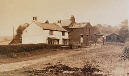 Fig3: this image is taken from Carr Lane looking up the hill on Melrose Way showing a surviving Red Bank house and a stable block behind it.
In the age of Stage Coaches the Inn was used to change horses, so would have had a stable attached.
Cary's New Itinerary (First Edition) of 1798 mentions Yarrow Bridge as a stopping point on the Wigan to Chorley road.
Cary's New Itinerary (First Edition) of 1798 mentions Yarrow Bridge as a stopping point on the Wigan to Chorley road.
|
|
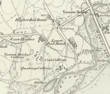
The 1844 OS First Edition map shows great detail of the dwellings in Upper and Lower Red Bank including gardens.
Coal mines developed in the 1840's (Carr Colliery, Yarrow Colliery and Duxbury Colliery) resulted in some growth in Red Bank.
Coal mines developed in the 1840's (Carr Colliery, Yarrow Colliery and Duxbury Colliery) resulted in some growth in Red Bank.
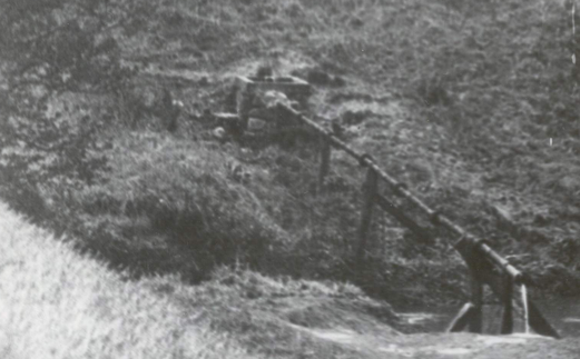
In the 1900's the main Lower Red Bank settlement seems to have been around a row of cottages now on the Telent site. There is an interesting photograph of the Yarrow crossing at that time showing the 'well' with a iron pipe running across the river to the Chorley side.
This well is still visible today, and I am pretty sure that the pipe is laying on the river bed. I need to visit again to look at it.
This well is still visible today, and I am pretty sure that the pipe is laying on the river bed. I need to visit again to look at it.
