I have been researching the routes between Chorley and Bolton along Chorley Old Road and Chorley New Road. I assumed that these were the only routes, but in my wandering round the area, I came across the possibility of another route around the other side of Anglezarke and Winter Hill.
Surely not I thought, maybe Chorley to Blackburn? This implies that there was a route from Brinscall to the Abbey Bridge area down to Belmont. However, I know that both Abbey Bridge and Belmont do not become established until around the 18th century.
Clue 2
There is a lovely walk from the car park just off the A675 that runs to the East, but parallel to the modern round through Belmont. It is a substantial ‘footpath’ and links the buildings and farms on the east side of Belmont Resovior. The route is now part of the ‘Witton Weavers Way’ and run some 50m higher up the side of Longworth Moor than the modern A675 and ignores Belmont, indicating that this could be an older route.
- Clue 1
Surely not I thought, maybe Chorley to Blackburn? This implies that there was a route from Brinscall to the Abbey Bridge area down to Belmont. However, I know that both Abbey Bridge and Belmont do not become established until around the 18th century.
Clue 2
There is a lovely walk from the car park just off the A675 that runs to the East, but parallel to the modern round through Belmont. It is a substantial ‘footpath’ and links the buildings and farms on the east side of Belmont Resovior. The route is now part of the ‘Witton Weavers Way’ and run some 50m higher up the side of Longworth Moor than the modern A675 and ignores Belmont, indicating that this could be an older route.
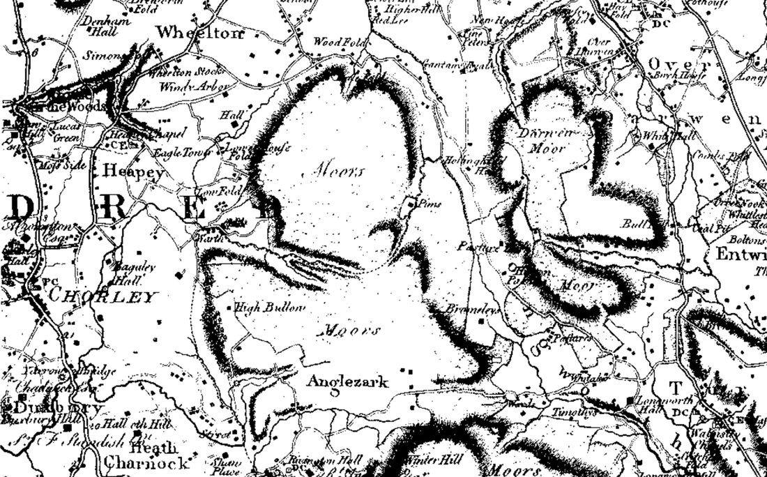
Looking at Yates 1786 map of Lancashire, you can clearly trace the full route. Note that Abbey Village and Belmont are not shown on this map. The route runs from Chorley to Heaney, then through Weelton where it leaves the turnpike road down to Brinscall and around the North of Anglezarke Moors. It then turns south down the valley, past Hollingshead Hall (now ruins) and then along the 320m contour line to Longworth Moor before dropping to Longworth Hall.
This is now close to the Blackburn to Bolton turnpike (A666) which probably completed the route.
This is now close to the Blackburn to Bolton turnpike (A666) which probably completed the route.
Why this route?
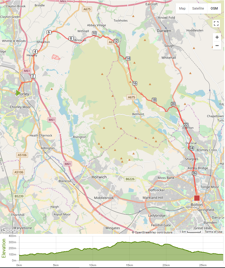
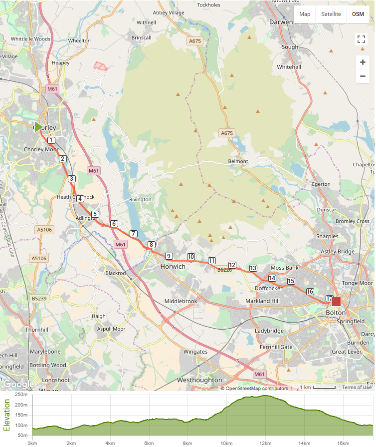
If we look at the profile of this route and compare it to Chorley Old Road we can see a difference. Surprisingly, this route reaches a height of just over 300m where as Chorley Old Road peaks at 250m. However, there are no steep inclines on this route with a much more gradual incline.
If we look at the profile of this route and compare it to Chorley Old Road we can see a difference. Surprisingly, this route reaches a height of just over 300m where as Chorley Old Road peaks at 250m. However, there are no steep inclines on this route with a much more gradual incline.
|
|
