This web site will be used to publish the results of investigations into interesting features in the landscape, buildings, routes and historic events in the Chorley area.
NEW ARTICLES
May 21
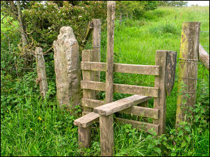
A Lancashire Mystery - Tenon Topped Gateposts Survey - While investigating The John Stone, I became aware of that there are many similar stones with a tenon in the Chorley/Leyland/Eccleston area, and they are known as Tenon Topped Gateposts.
It is next to impossible to determine the purpose or age of these stones individually, but by visiting each one (there may be as many as 30) and looking at the location and historic land ownership we may be able to get some clues.
Click here for more. If you know of any more of these stones, or if you have any ideas as to what they might have been used for, please complete the survey form at the bottom of the Survey page.
April 21
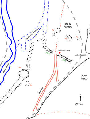
The John Stone Survey, Duxbury - In Duxbury Woods, there is a mysterious stone post with an old ditch running past it.
I have just published the initial results of a recent visit to survey the area around the stone to see if any clues emerge as to its purpose.
Click here for more.
I have just published the initial results of a recent visit to survey the area around the stone to see if any clues emerge as to its purpose.
Click here for more.
May 20
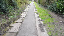
Burgh Colliery Railway - A rail track ran from Burgh Lane to a terminal at Pall Mall in the 19C. There are still a few traces of it to be found. Click here for more.
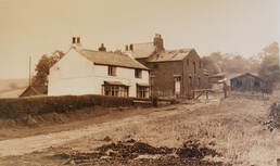
The History of Red Bank - South Chorley.
Taking advantage of the lockdown, I am pulling together all the information I have on my local area of Red Bank, a key area for hundreds of years. Click here to read more
Taking advantage of the lockdown, I am pulling together all the information I have on my local area of Red Bank, a key area for hundreds of years. Click here to read more
April 20
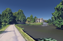
Google Earth 3D model of Chorley area is now available which allows you to explore anywhere you want. Click here to read more.
February 20
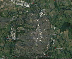
Analysis of the 1726 boundary walk of Chorley. Tying to find the places mentioned. Click here to read more.
June 19
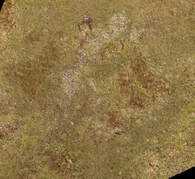
Second target surveyed in 2019 on Anglezarke. A line of stones within a rectangular crop mark near Jepson's Gate. Click here to read more.
May 19
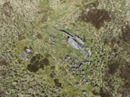
Carrying out drone surveys of sites mentioned in the 1985 Archaeological Survey of Anglezarke, starting with Site 82 - Pikestones. Click here to read
|
Processing images from aerial survey over Black Coppice, Anglezarke. Shows very clearly the partially made millstones and the chambered cairn. Looking to see if there are any other features. Click here for more.
|

Chambered cairn at Black Coppice, Anglezarke, identified in 1980's modelled. I have been looking for this for the last 10 years. Click here for more.

New area of research. Looking at 1890's OS maps there are over 35 Pedestal of Stone Crosses marked. Already visited several, and created 3D models, and will use to map medieval routes and boundaries. More articles to follow.
February 19

Updated some recent visits to cross sites and started to process the latest 3D models.
Started work on new Medieval Religious Sites page (launch Jan 19) and Douglas Navigation page.
Started work on new Medieval Religious Sites page (launch Jan 19) and Douglas Navigation page.
December 18

I have created so many 3D models of wayside crosses and pedestals in the last 6 months, i have decided to create an A - Z page so that they are easier to find. Completed A - P so far. Click here to view.
Sept 18

Started to write up results of survey of crosses in the Sefton area in West Lancs.
Some spectacular crosses here. Click here to read more.
Some spectacular crosses here. Click here to read more.
July 18
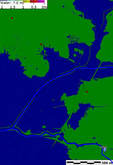
Flood analysis carried out on elevation data on the Bretherton to Croston route defined by 4 wayside crosses. Click here to read more.
June 18
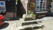
Croston market cross, Sara Lane cross and Bretheton Cross 3D models uploaded to the new Wayside Cross survey page. Click here to read more.
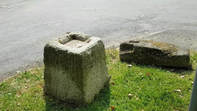
Penwortham Priory Cross, Howick Cross and Sollom Cross 3D models uploaded to the new Wayside Cross survey page. Click here to read more.
April 18

3D models of Turton Moor boundary stones produced. Click here to read the article.

Walked up Turton Moor to view Cheetham Close stone circle and ring cairn. Article coming soon with 3D models of some features.
March 18
|
Boundary stone known as 'The John Stone' located in Duxbury Woods. Click here to read the artilce.
|

Foot survey of of full 2km of Devil's Ditch. Click here to read more
February 18
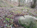
Possible boundary stone found in Coppull Hall Woods on the Duxbury side of Eller Brook.
Click here to read more.
Click here to read more.
January 18
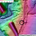
New page started for Tinkler's Barracks 29-Jan-18. Click here to view.
Anglezarke Survey - 3D model of James Yates Well published on Sketchfab. Click here to view.

Anglezarke Survey - James Yates Well survey published
9-Jan-18
9-Jan-18

Survey for ruin on Rushy Brow released
I am trying to add analysis and information to the many sites of interest in our area by visiting sites to photograph, produce 3D models, elevation maps, including NDVI vegetation analysis to see if we can extract more information about these features.
Data will be extracted from old maps, lidar data and, if suitable, conduct a drone survey with photogramatary analysis of drone images.
Over time, I will also put links to some of the many free sources of information there are now on the internet, and add short turorials on how you can, with little more than a mobile phone, explore and document features.
Topics for investigation
- Prehistoric monuments
- Routes of old roads
- Halls and estates
- River fords and bridges
- Historic Inns in the area
- Lost boundary stones and wayside crosses
Wayside Crosses in the Leyland Hundred Survey
There are around 50 'Pedestal of Stone Cross' marked on the 1846 OS map between Preston, Chorley, Wigan and Burscough, and many are still around today.
The aim of this survey is to track down the remaining ones and record them with a 3D model if possible, and look into the history of these medieval features that lie in forgotten corners and lanes of West Lancashire.
Click here to read more.
The aim of this survey is to track down the remaining ones and record them with a 3D model if possible, and look into the history of these medieval features that lie in forgotten corners and lanes of West Lancashire.
Click here to read more.
Anglezarke Survey
The initial focus for 2018 will be to carry out an archaeological survey of many of the features on Anglezarke Moors.
Desk Survey
Using to 0.5m lidar data for Anglezarke, aerial images and trawling the internet for background information, an initial assessment of each feature will be drawn up.
Detail Survey
Using a drone, a 2cm aerial survey will be carried out on sites where this seems appropriate. This will produce overhead shots, 3D models and vegetation health analysis which be used to produce accurate drawings of each site.
2019
Visiting and surveying the 1985 Archaeological Survey of Anglezarke and Rivington.
How to carry out a local history investigation yourself
An investigation will often start from browsing around the internet and reading about a particular feature, or spotting something out on a walk. By repeatedly searching for the feature, you can often draw up a fair amount of information.
Old maps are full of useful information. There are 2 excellent sites that give you access to detailed OS maps from the mid 1840's onwards.
National Library of Scotland
Old-maps.co.uk
Also Lancashire County Council's MARIO maps give current information from the council with historic data as well.
You can sometimes find tithe maps that can take you some 20 years earlier, but not many are online. If you need more detail than this, you can try the Lancashire Records Office at Preston which also has an online catalogue.
Aerial imagery is the next place to look.
Google Earth has a History setting so that you can roll the images back over time, in some instances to images taken in the 1940's. When looking at moors, you find that all the historical images are taken at different times of the year, and the different conditions will show the feature in different ways.
Lidar data is now available for over 72% of the country at 1m resolution. Have a look at the excellent online Lidar Finder at https://www.lidarfinder.com/. Anglezarke and Winter Hill have a higher resolution of 0.5m.
If you want to investigate further, raw data can be downloaded from the Environment Agency and analysed using GIS software to produce various DEM models (Digital Elevation Models) and Hillshade images. By varying the angle and elevation of the sun, you can often extract far more detail.
This data can also produce 3D objects that can be analysed further, for example, by dissecting to look at profiles.
Detailed investigation
The aim of a detailed investigation is to produce an accurate drawing of the feature. This may combine positional information from many sources, including aerial images, elevation images, maps and produced orthometric images.
Photogrammetry survey
In order analyse a feature in more detail, you need a set of overlapping photographs. These photographs can be from a drone or a camera (mobile phone). The photographs can then be uploaded into photogrammetry software to produce:
- orthometric map
- 3d model with textures
- NDVI vegetation analysis
- Elevation image
- Contour map
- Overhead photograph
- Drawing of feature
The level of detail can be between 2-5cm for drone survey of several acres, or under 1cm for smaller areas. If using a drone, you can also take an overhead shot of the feature.
Producing a detailed Drawing
Using an a combination of aerial images, elevation images, maps and produced orthometric images
of the highest detail you can obtain, you can then use a drawing package to produce an accurate drawing by accurately position each image on top of each other.
- Using layers, you can
- load the background framework
- Load overhead image(s)
- Draw main feature
- Draw comments and scale
