At the top of Hogg's Lane, just behind the bridge over the canal, used to be a set of 4 cottages by the canal tow path.
I have walked past this spot many times and never noticed anything.
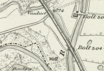
They appear first on the 1844 OS map (not labelled) and which shows an approach road and an out-building. On all subsequent maps they are labelled Tinkler's Barracks.
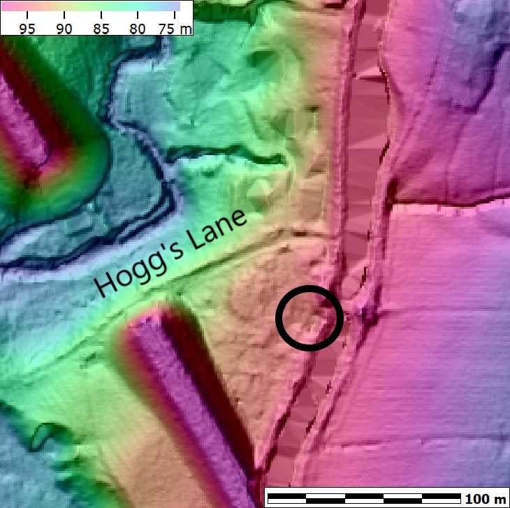
I have produced an elevation map from the lidar data on the Data.gov.uk and you can still see the footprint of the dwellings by the side of the canal (circled in black). I will have to have a good look next time we walk the canal and add more detail.
I have walked past this spot many times and never noticed anything.
They appear first on the 1844 OS map (not labelled) and which shows an approach road and an out-building. On all subsequent maps they are labelled Tinkler's Barracks.
I have produced an elevation map from the lidar data on the Data.gov.uk and you can still see the footprint of the dwellings by the side of the canal (circled in black). I will have to have a good look next time we walk the canal and add more detail.
|
|
I photographed the area of Tinklers Barracks recently. The flat platform for 4 houses is evident, but little else.
|