CHORLEY, DUXBURY, ADLINGTON LOCAL HISTORY
  • Home
  • Local History
    • John Stone - Survey
    • Red Bank
    • Burgh Colliery Railway
    • Chorley Boundary survey 1726
    • Google Earth 3D view of Chorley
    • Tinkler's Barracks
    • Roscoe Lowe - Samuel Oldknow
    • The search for the original Yarrow Bridge Inn
    • Hall o'th Hill
    • Lead Clough Mines - Anglezarke
  • Tenon Top Gateposts
  • Wayside Crosses
    • A-Z Lancashire surviving wayside crosses
    • Bretherton to Croston
    • Longton to Penwortham
    • Wigan to Chorley >
      • Bloody Stone - Newton-le-Willows
    • Hightown to Sefton
    • Mystery of Headless Cross Anderton
  • Anglezarke Survey
    • Site 76-77 - Anglezarke
    • Site 82 - Pikestones
    • Millstone Quarry - Black Coppice
    • Chambered Round Cairn - Site 40
    • Devil's Ditch
    • James Yates Well - Anglezarke
    • Rushy Brow Ruin - Anglezarke
    • Pike Stones Cairn
    • Round Loaf
    • Noon Hill
    • Pike Stones
    • Jepsons Gate Cairn
    • Pikestones Row
  • Roads
    • The John Stone - Duxbury Woods
    • Boundary Stone - Duxbury Coppull
    • The Old Yarrow Bridge
    • Ogilby Road Map
    • 15C route between Chorley and Bolton?
    • 14 Boundary Mounds on Anglezarke
    • Boundary Stones - Turnton Moor
  • Civil War
    • Colonel Thornhaugh
    • The Battle of Wigan Lane
  • News blog posts
  • Contact
  • Knights Hospitallers
  • Dean Ditch Boundary Stones
  • Ribble Ford
  • Lancashire Coast Elevation Map
  • Lancashire Coast Lidar Map
  • New Page
  • New Page

The Old Yarrow Bridge

The Old Yarrow Bridge


Yarrow Bridge on the A6 south of Chorley

The current Yarrow Bridge (on the A6 just outside Chorley) was built around 1824 when the old turnpike road from Chorley to Duxbury Stocks was re-routed and modernised.  The original route of the turnpike can easily be retraced [Route of the old A6] using old maps, as well as identifying the industry and buildings, including the Yarrow Bridge Inn, that were around the original crossing of the Yarrow at Red Bank.  Miles Standish Way runs some 20 meters from this crossing.

How to find the Old Yarrow Bridge


Take the path running from Duxbury Hall Lodge towards Duxbury Hall , and after a few hundred meters head down to the river Yarrow.  There you can still see the footings of the original Yarrow Bridge. 

In fact, it is possible that there are two sets of footings for two different bridges. Footings are visible on both banks, and on the Duxbury bank, the roadway can still clearly be seen running up towards the road/path from Chorley Lodge.


There is also a horse trough on the Duxbury bank (maker as a Well on old maps) which may have belonged to the original Yarrow Bridge Inn.

When was the first Yarrow Bridge built?


Saxton's map of 1579 shows a bridge over the Yarrow between Charley (Chorley) and Adlington and Blackrod.

This layout of The peel and a bridge to Hyll (moated site at Bretters Farm?) then appears repeatedly for the next 200 years
.

When did the bridge go out of use?

The last map I have found showing the bridge is on plans drawn up for the re-routing of of the Chorley to Adlington turnpike in 1824.


Picture
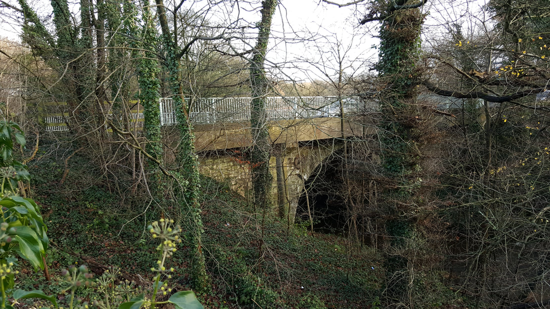
Today's Yarrow Bridge on the A6 leaving Chorley and build around 1824.
Picture
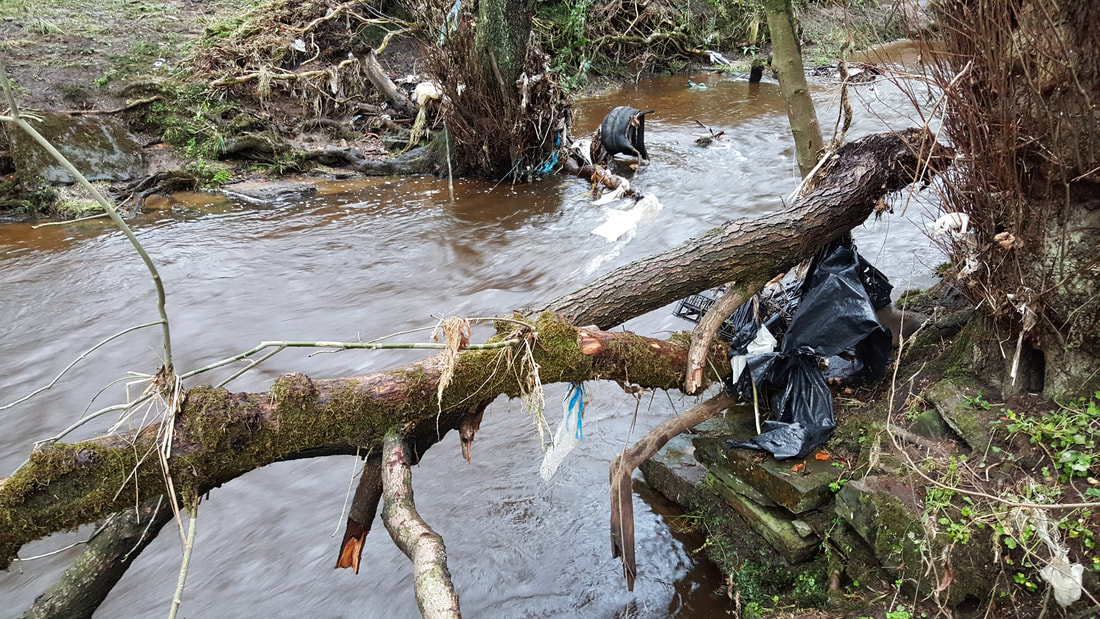
Footings of the bridge re-built in 1760's showing 200m down river from today's bridge
Picture
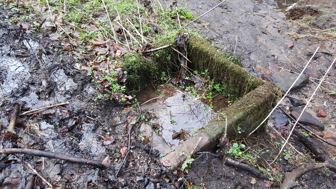
Stone horse trough on the Duxbury bank
Picture
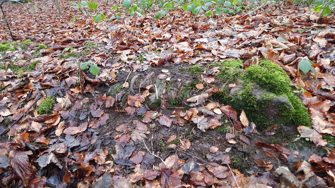
Move a few leaves, and you can see the cobbled surface of the old A6 on the footings of the bridge
Picture
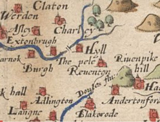
Saxton's map of 1579 showing a bridge over the Yarrow south of Charley
Picture
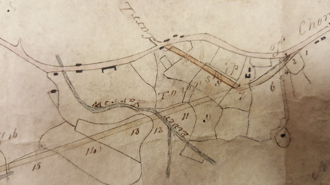
Hand drawn plans from 1824 showing both the original route of the A6 (upper) and the proposed new route (lower)
Powered by Create your own unique website with customizable templates.
  • Home
  • Local History
    • John Stone - Survey
    • Red Bank
    • Burgh Colliery Railway
    • Chorley Boundary survey 1726
    • Google Earth 3D view of Chorley
    • Tinkler's Barracks
    • Roscoe Lowe - Samuel Oldknow
    • The search for the original Yarrow Bridge Inn
    • Hall o'th Hill
    • Lead Clough Mines - Anglezarke
  • Tenon Top Gateposts
  • Wayside Crosses
    • A-Z Lancashire surviving wayside crosses
    • Bretherton to Croston
    • Longton to Penwortham
    • Wigan to Chorley >
      • Bloody Stone - Newton-le-Willows
    • Hightown to Sefton
    • Mystery of Headless Cross Anderton
  • Anglezarke Survey
    • Site 76-77 - Anglezarke
    • Site 82 - Pikestones
    • Millstone Quarry - Black Coppice
    • Chambered Round Cairn - Site 40
    • Devil's Ditch
    • James Yates Well - Anglezarke
    • Rushy Brow Ruin - Anglezarke
    • Pike Stones Cairn
    • Round Loaf
    • Noon Hill
    • Pike Stones
    • Jepsons Gate Cairn
    • Pikestones Row
  • Roads
    • The John Stone - Duxbury Woods
    • Boundary Stone - Duxbury Coppull
    • The Old Yarrow Bridge
    • Ogilby Road Map
    • 15C route between Chorley and Bolton?
    • 14 Boundary Mounds on Anglezarke
    • Boundary Stones - Turnton Moor
  • Civil War
    • Colonel Thornhaugh
    • The Battle of Wigan Lane
  • News blog posts
  • Contact
  • Knights Hospitallers
  • Dean Ditch Boundary Stones
  • Ribble Ford
  • Lancashire Coast Elevation Map
  • Lancashire Coast Lidar Map
  • New Page
  • New Page