Survey of ruin on Rushy Brow - Anglezarke
After completing the drone survey at James Yates Well, there was still 5 minutes flight time left on the drone so I decided to run a quick flight over the ruins near
Rushy Brow. Just managed to video the approach, take a dozen overhead shots from different angles, which was just enough to produce a Digital Elevation Model.
Rushy Brow. Just managed to video the approach, take a dozen overhead shots from different angles, which was just enough to produce a Digital Elevation Model.
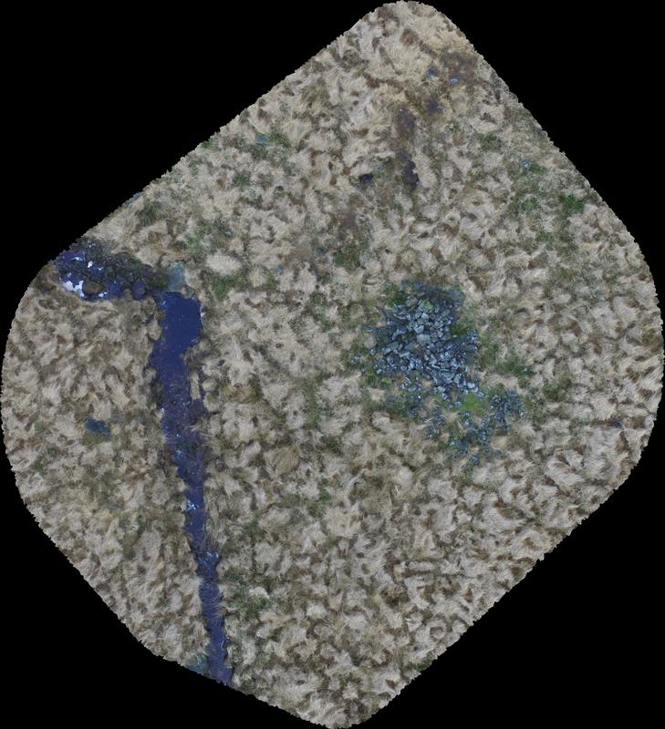 Fig1: Orthometric image
An orthometric image was produced to take measurements.
There is a pile of stones there that at first glance look like a cairn, but the orthometric image shows a rectangular spread 6m by 4m.
There also appears to be a ditch a few meters to the north.
There is a pile of stones there that at first glance look like a cairn, but the orthometric image shows a rectangular spread 6m by 4m.
There also appears to be a ditch a few meters to the north.
Taking a ‘slice’ out of the 3D model (north to south) you can see the profile of the ditch and the height of the pile of stones (see Fig2).
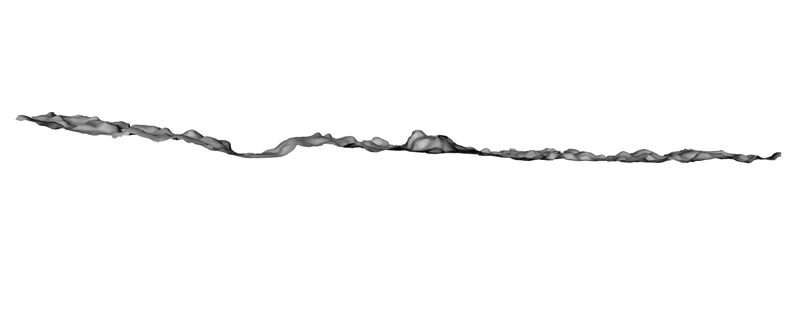
Fig2: cross section showing ditch and rubble pile
more text
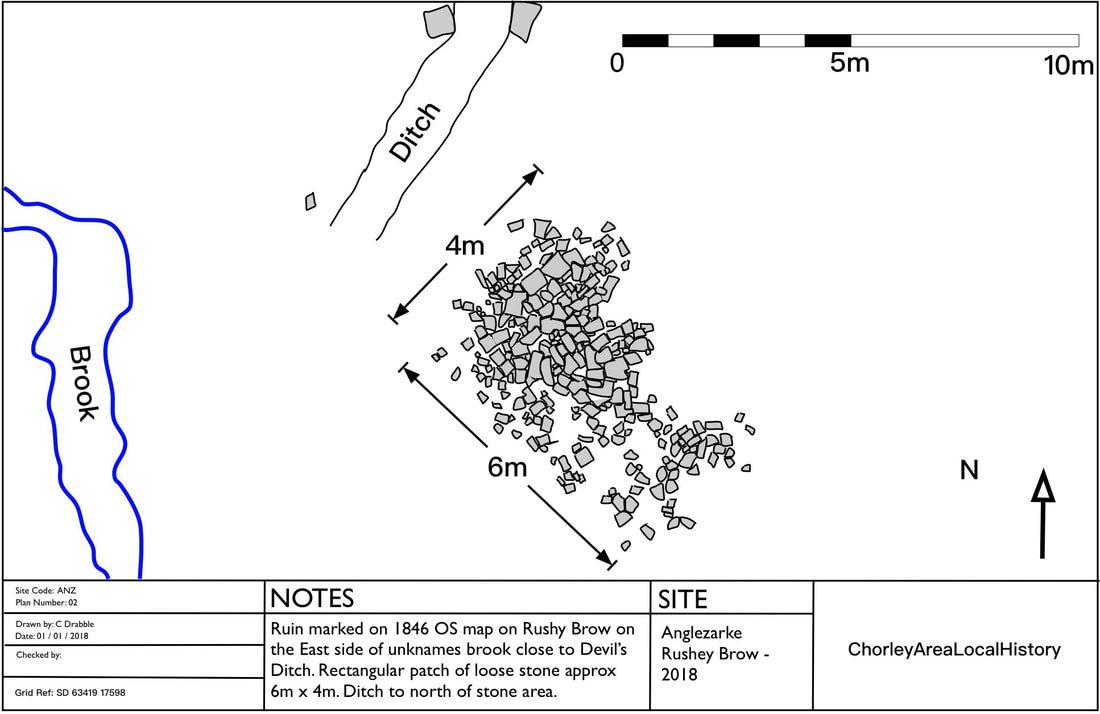
Fig3: Drawing produced from overlaying all images and data
Conclusions
This site was probably a building, maybe a Shooting Hut or a Sheep Fold. There are no signs on the detailed overhead shots of roofing material.
This site was probably a building, maybe a Shooting Hut or a Sheep Fold. There are no signs on the detailed overhead shots of roofing material.
