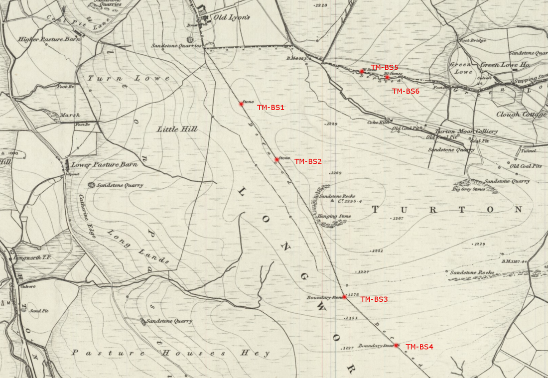
On the 1844 OS map there are several boundary stones marked on the Parish boundary that runs across Turnton Moor, and some of these are still visible today.
Since 1844 a dry stone wall has been built along most of the boundary.
Using a GPS package, the map below was attached to Google Maps to pinpoint the first 4 boundary stones. If care is taken with the alignment, an accuracy of 3m is achievable, which even in open moorland, is sufficient to locate a stone.
Parking at Crookfield Rd car park, off Belmont Rd, it is a climb to the top of the moor up the old 'Coal Pit Lane'. From Old Lyon's, it is a relatively easy walk along the boundary wall to Hanging Stone and beyond.
|
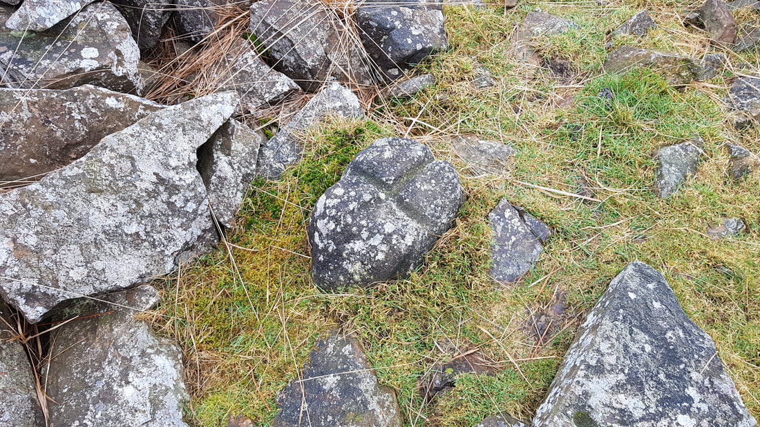
TM-BS1
The dry stone wall has been build directly over this boundary stone, but the wall has tumbled at this point exposing the boundary stone. The stone is only a few centimetres high, and about 15cm x 10cm. The stone has a cross cut into the top surface. |
There was no visible trace of TM-BS2 even though the wall had tumbled at this point.
|
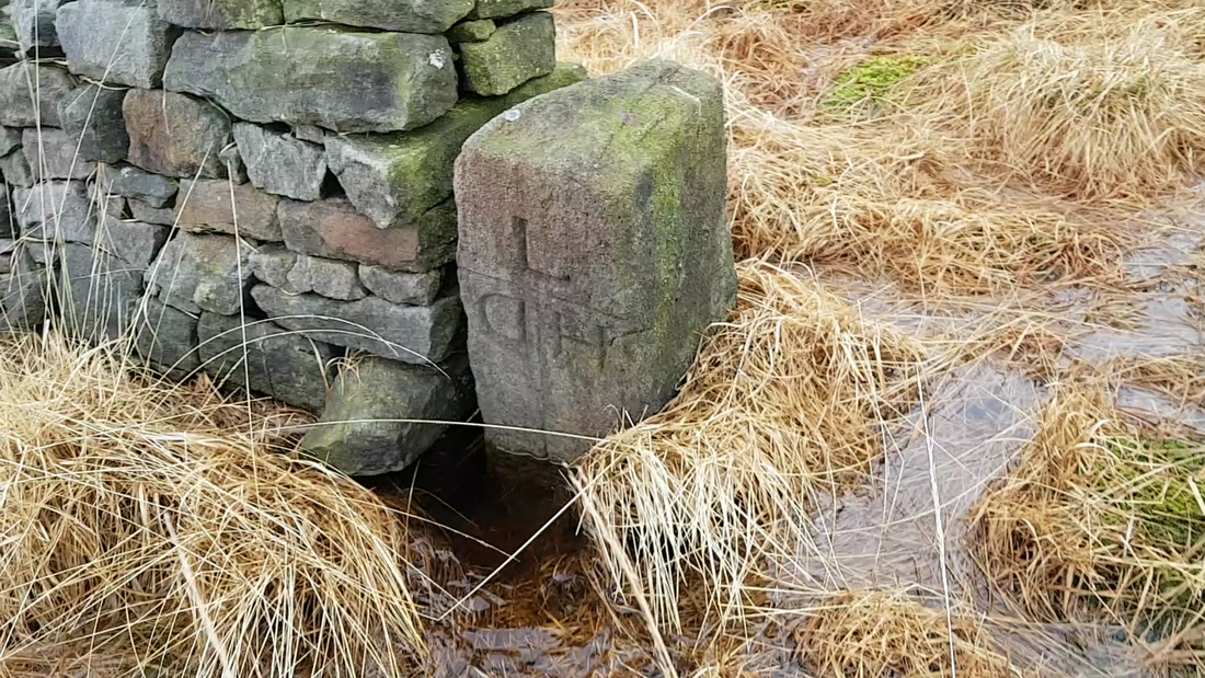
TM-BS3
The third boundary stone is marked on the 1846 OS map at the point where there is a slight change in direction in the boundary. Although the dry stone wall had fallen at this point, there was no sign of any boundary stone. However, some 50m along the wall, where the wall terminated, there was a marked stone at the end of the wall. Marked with T / H / D on east side and L / H / D on the west side. The D is back to front?? It is possible that there is a cross shape marked on top similar to neighbouring stones, but this is not clear. It is possible that this stone was moved when the dry stone wall was constructed. |
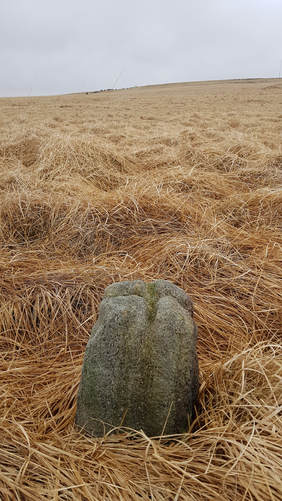
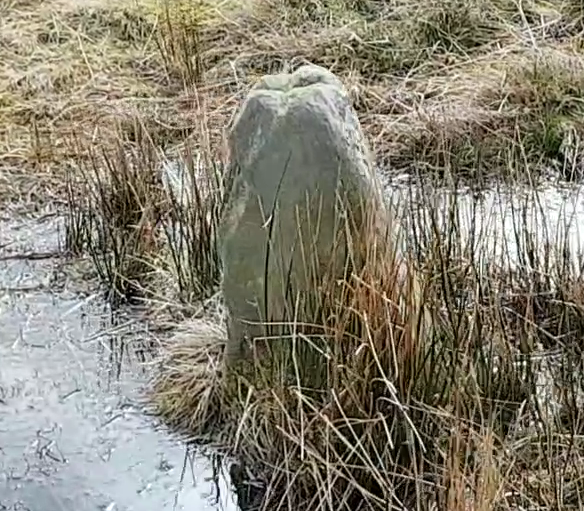
TM-BS4
The fourth boundary stone is alone in an open section of the moor. It is hard to find if you do not have a gps system with the location of the stone marked. Only 16cm tall, marked with cross shape on top. Identical to TM-BS1 boundary stone some 1km north on the same boundary.
The fourth boundary stone is alone in an open section of the moor. It is hard to find if you do not have a gps system with the location of the stone marked. Only 16cm tall, marked with cross shape on top. Identical to TM-BS1 boundary stone some 1km north on the same boundary.
|
Cheetham Close Stone Circle - Turnton
Just over a mile to the south east, is the remains of Cheetham Close Stone Circle. One of the outlier stone (the only stone that looks to be in its original standing position) also has a similar cross carved onto the top of it. There is no suggestion that the cross mark is prehistoric, but the stone may also have been used as a boundary marker at the same time as the Turton Moor boundary stones were set up. |
Does anyone know what boundary these stones are marking or have any views?
