CHORLEY, DUXBURY, ADLINGTON LOCAL HISTORY
  • Home
  • Local History
    • John Stone - Survey
    • Red Bank
    • Burgh Colliery Railway
    • Chorley Boundary survey 1726
    • Google Earth 3D view of Chorley
    • Tinkler's Barracks
    • Roscoe Lowe - Samuel Oldknow
    • The search for the original Yarrow Bridge Inn
    • Hall o'th Hill
    • Lead Clough Mines - Anglezarke
  • Tenon Top Gateposts
  • Wayside Crosses
    • A-Z Lancashire surviving wayside crosses
    • Bretherton to Croston
    • Longton to Penwortham
    • Wigan to Chorley >
      • Bloody Stone - Newton-le-Willows
    • Hightown to Sefton
    • Mystery of Headless Cross Anderton
  • Anglezarke Survey
    • Site 76-77 - Anglezarke
    • Site 82 - Pikestones
    • Millstone Quarry - Black Coppice
    • Chambered Round Cairn - Site 40
    • Devil's Ditch
    • James Yates Well - Anglezarke
    • Rushy Brow Ruin - Anglezarke
    • Pike Stones Cairn
    • Round Loaf
    • Noon Hill
    • Pike Stones
    • Jepsons Gate Cairn
    • Pikestones Row
  • Roads
    • The John Stone - Duxbury Woods
    • Boundary Stone - Duxbury Coppull
    • The Old Yarrow Bridge
    • Ogilby Road Map
    • 15C route between Chorley and Bolton?
    • 14 Boundary Mounds on Anglezarke
    • Boundary Stones - Turnton Moor
  • Civil War
    • Colonel Thornhaugh
    • The Battle of Wigan Lane
  • News blog posts
  • Contact
  • Knights Hospitallers
  • Dean Ditch Boundary Stones
  • Ribble Ford
  • Lancashire Coast Elevation Map
  • Lancashire Coast Lidar Map
  • New Page
  • New Page

Bloody Stone - Newton-le-Willows

Picture
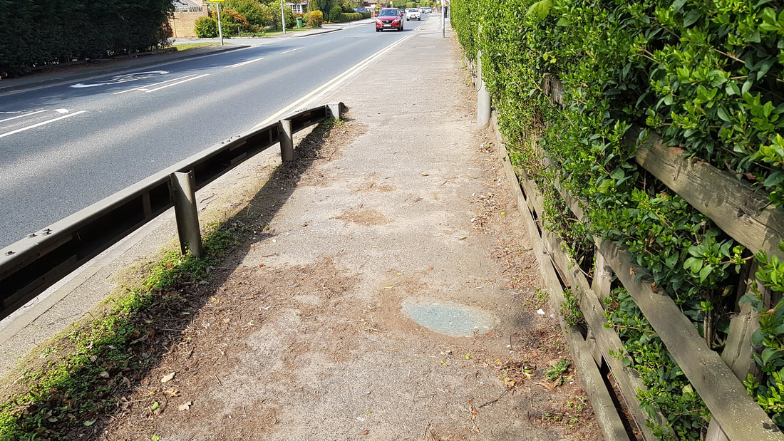
Marked on the OS 1846 map for Newton-le-Willows is the 'Bloody Stone' which is related to Mabs Cross in Wigan.

It is sited on the A49 on the outskirts of Newton-le-Willows on the road to Warrington.  I have seen old photographs with the stone being set into the kerb, but now it is set back near to the fence, but still visible.

Bloody Stone - Newton-le-Willows by csdrabble on Sketchfab

Powered by Create your own unique website with customizable templates.
  • Home
  • Local History
    • John Stone - Survey
    • Red Bank
    • Burgh Colliery Railway
    • Chorley Boundary survey 1726
    • Google Earth 3D view of Chorley
    • Tinkler's Barracks
    • Roscoe Lowe - Samuel Oldknow
    • The search for the original Yarrow Bridge Inn
    • Hall o'th Hill
    • Lead Clough Mines - Anglezarke
  • Tenon Top Gateposts
  • Wayside Crosses
    • A-Z Lancashire surviving wayside crosses
    • Bretherton to Croston
    • Longton to Penwortham
    • Wigan to Chorley >
      • Bloody Stone - Newton-le-Willows
    • Hightown to Sefton
    • Mystery of Headless Cross Anderton
  • Anglezarke Survey
    • Site 76-77 - Anglezarke
    • Site 82 - Pikestones
    • Millstone Quarry - Black Coppice
    • Chambered Round Cairn - Site 40
    • Devil's Ditch
    • James Yates Well - Anglezarke
    • Rushy Brow Ruin - Anglezarke
    • Pike Stones Cairn
    • Round Loaf
    • Noon Hill
    • Pike Stones
    • Jepsons Gate Cairn
    • Pikestones Row
  • Roads
    • The John Stone - Duxbury Woods
    • Boundary Stone - Duxbury Coppull
    • The Old Yarrow Bridge
    • Ogilby Road Map
    • 15C route between Chorley and Bolton?
    • 14 Boundary Mounds on Anglezarke
    • Boundary Stones - Turnton Moor
  • Civil War
    • Colonel Thornhaugh
    • The Battle of Wigan Lane
  • News blog posts
  • Contact
  • Knights Hospitallers
  • Dean Ditch Boundary Stones
  • Ribble Ford
  • Lancashire Coast Elevation Map
  • Lancashire Coast Lidar Map
  • New Page
  • New Page